From WIRED Magazine – by Mary Bates
Interesting read from the wires… how those Salmon and Steelhead get back to the creeks they were born in.
Salmon Inherit a Magnetic Map
Young salmon with no experience of the world, and without any guidance, are able to use the Earth’s magnetic field to find locations on the other side of the ocean. Using an inherited magnetic GPS, these fish can find favorable feeding grounds that generations of salmon have frequented.
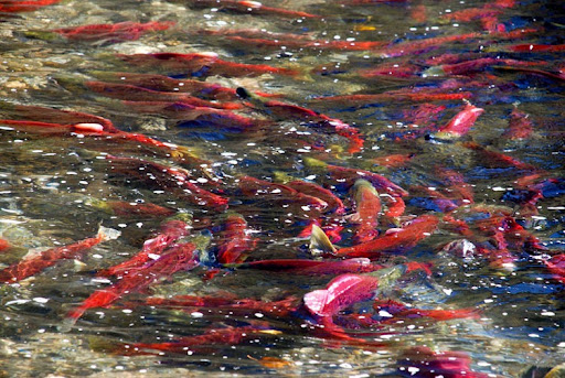
Chinook salmon hatch in freshwater but migrate to the ocean, where they spend several years. They then make a single return migration to spawn in freshwater, typically near where they hatched, and die after the breeding season.
Nathan Putman, along with colleagues from Oregon State University, the University of Washington, the University of North Carolina, and the Oregon Hatchery Research Center, thought young salmon might be depending on a navigation system based on inherited instructions. Such a map has thus far been demonstrated in only one animal: hatchling loggerhead sea turtles, who use an inherited magnetic map to navigate the open ocean and find feeding grounds.
Salmon, like sea turtles, are able to leave their hatching site and find specific areas in the ocean with no prior experience or elder animals to lead them. An inherited map would let these animals know where they are and be available even with no migratory experience.
Animal Magnetism
There is a growing body of work showing diverse animals use the magnetic field of the Earth to orient their movements. Because of its gradual and regular gradients across the globe, it seems like one of the few environmental features that would really be useful to an animal traveling long distances.
Putman and his colleagues used a magnetic coil system to test young Chinook salmon with no migratory experience. They created magnetic fields like the ones that exist in parts of the salmon’s ocean range by changing the amperage running through copper wires surrounding the buckets that held the fish. “If the fish used the magnetic field to know where they are, we could make them think that they were north or south of their typical oceanic range by changing the field around them,” says Putman.
The team used two magnetic parameters. Field intensity is the magnitude of Earth’s magnetic field, and generally increases as one gets closer to the poles. Inclination angle is the direction of the field relative to Earth’s surface. It is 90° at the poles and progressively less steep at the equator. The gradients of these two parameters are not parallel and so geographic locations have unique “magnetic addresses” defined by a combination of intensity and inclination. An animal that detects both of these magnetic features would in effect have both latitudinal and longitudinal information about where it was.
Photo: U.S. Forest Service, Sawtooth National Recreation Area, Fredlyfish4 (Own work) [Public domain], via Wikimedia Commons
Putman and his colleagues showed that salmon rely on both parameters to orient their movements. First, exposing fish to a combination of intensity and inclination angle that exists to the north of their normal range elicited southward swimming, whereas exposing them to an intensity/inclination pairing that exists to the south elicited northward swimming. In these cases, the salmon responded to the magnetic fields by swimming in the direction that would lead them toward the center of their oceanic range.
Next, the researchers mixed up the pairings, presenting the fish with an intensity that exists to the north and an inclination angle that exists in the south. “If fish only used intensity to navigate they would go south, if they only used inclination they would go north, but if they used both they would be confused and go randomly,” Putman says. The salmon oriented randomly in that experiment, suggesting they are using both parameters to assess their location.
An Inherited GPS
Putman and his colleagues suggest the salmon’s magnetic map is inherited because the fish they tested had never been anywhere but the testing facility, and so had never had the opportunity to learn how the magnetic field varies with space. “Nothing about swimming around a 6-foot tank in western Oregon would tell you that if you find yourself in a stronger intensity and steeper inclination than your current location, such a field corresponds to a more northern location and you should swim south,” says Putman.
According to Putman, magnetic maps might be even more widespread in marine animals. The ocean is challenging to navigate: there are currents, eddies, and storms to deal with and there are no stationary visual references to rely on. Because the Earth’s magnetic field varies predictably across the globe, animals can use magnetic information to figure out where they are, where they want to go, how to set a course to get there, and how to correct for errors that arise. “Given that two very distantly related species (sea turtles and salmon) show this behavior, my suspicion is that other marine animals that travel long distances are likely to possess this ability as well, due to convergent evolution,” Putman says.
What else might be using magnetic maps to navigate the ocean? Some species that might be worth examining next are tuna, sharks, eels, and perhaps even marine mammals like seals and whales or marine birds like penguins. An inherited magnetic map is such a valuable asset in the vast ocean that many species may have arrived at it as a solution for making long journeys.
Reference:
Putnam, N. F., Scanlan, M. M., Billman, E. J., O’Neil, J. P., Couture, R. B., Quinn, T. P., Lohmann, K. J., and Noakes, D. L. G. (2014). An Inherited Magnetic Map Guides Ocean Navigation in Juvenile Pacific Salmon. Current Biology 24: 1-5. doi: 10.1016/j.cub.2014.01.017.

![By U.S. Forest Service, Sawtooth National Recreation Area, Fredlyfish4 (Own work) [Public domain], via Wikimedia Commons](https://www.wired.com/images_blogs/wiredscience/2014/02/Chinook_Salmon_in_SNRA-660x495.jpg)