Lost River Maps – Missouri River
$9.99
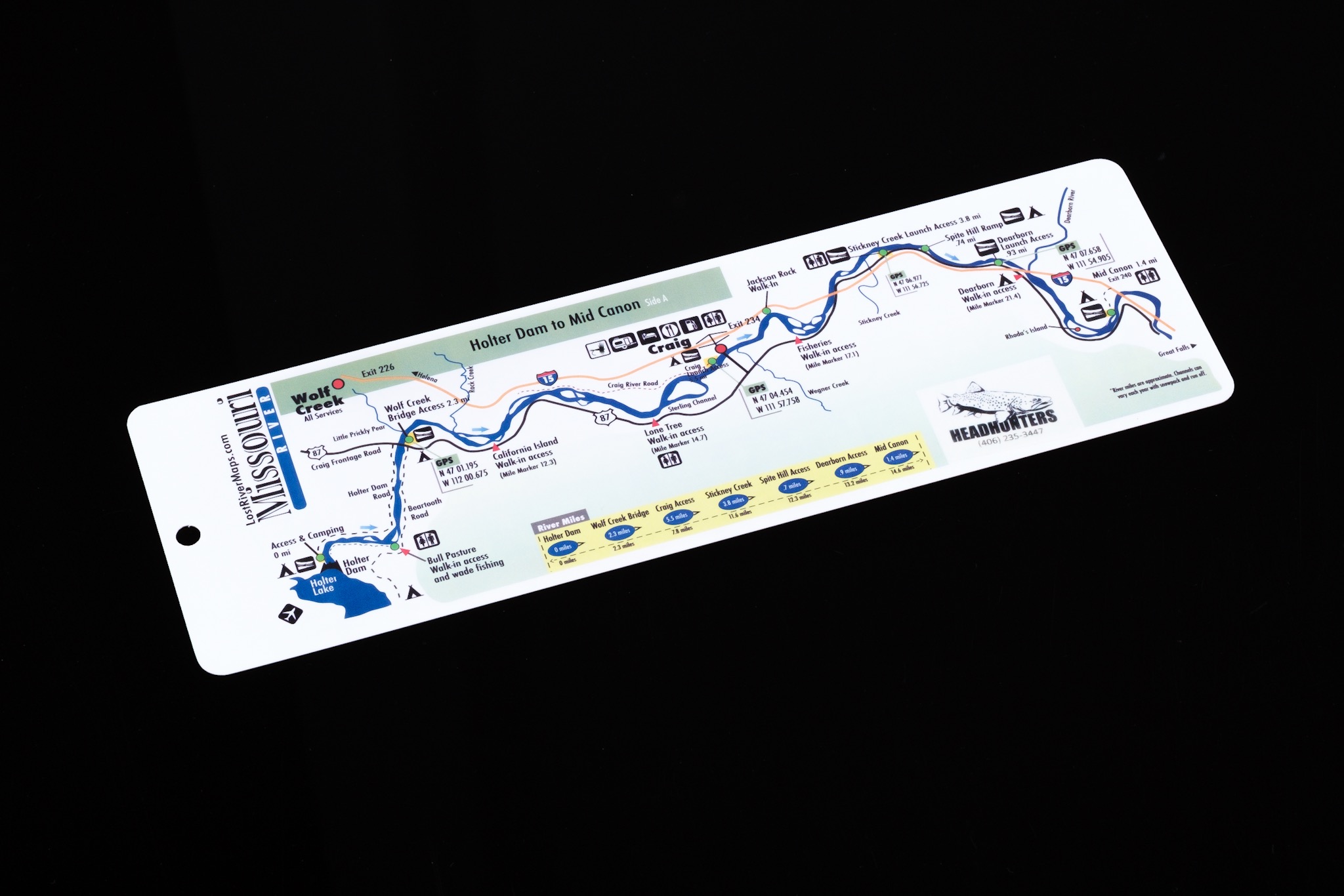
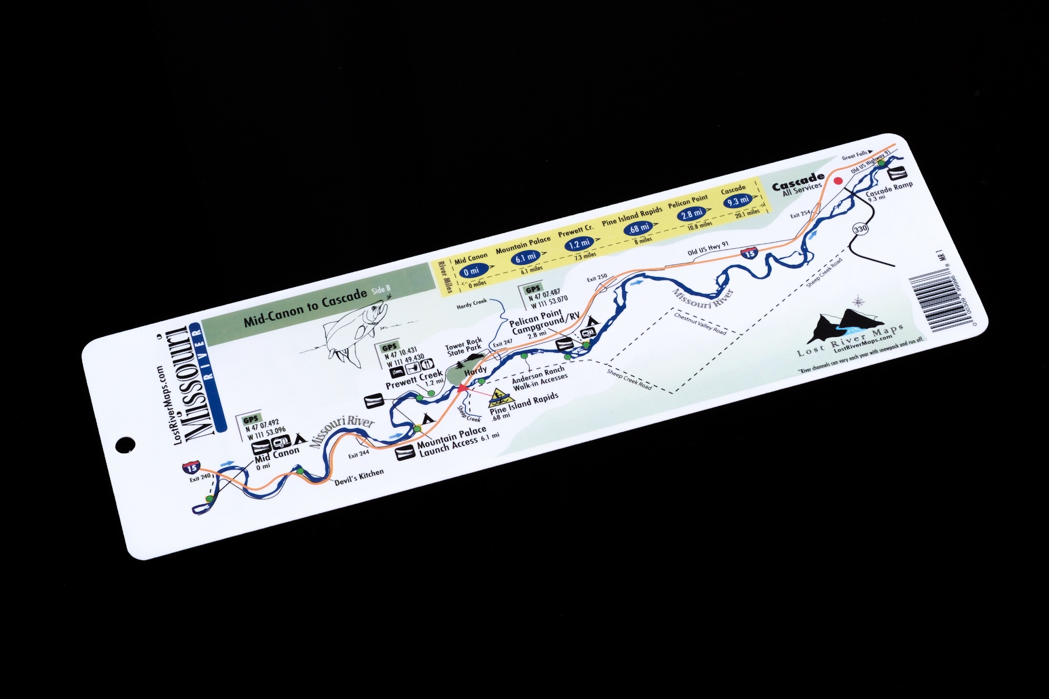
HEADHUNTERS SAYS These are excellent, water proof map cards that are easy to stash in your rig, boat, tackle bag and even your vest. For how small this map is, it shows a surprising amount of detail. All public access points are marked, many with GPS locations. It also show floating mileage and uses icons to locate fly shops, campgrounds, boat ramps, outhouses, and food/lodging. Printed on a tough flexible plastic card that measures 3.5” x 11.25”.
Category: Terminal Tackle
Tag: Fishing map
Be the first to review “Lost River Maps – Missouri River” Cancel reply

Reviews
There are no reviews yet.